
Lidar 3D Laser Scanning for Industrial,
Commercial & Infrastructure Projects
3D Laser Scanning
Services
Capture Existing Conditions with Survey-Grade Precision
WildPlantTS provides professional 3D Laser Scanning Services using advanced Terrestrial LiDAR technology to create highly accurate digital representations of existing facilities, industrial plants, buildings, and infrastructure.
What is 3D Laser Scanning?
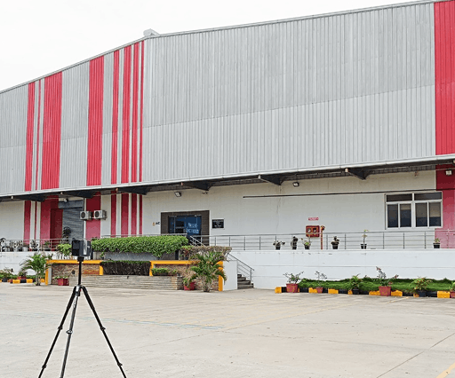
3D Laser Scanning is a Reality Capture technology that uses Terrestrial LiDAR (Light Detection and Ranging) to measure the physical environment with millimetre-level accuracy.
A laser scanner rotates 360 degrees while emitting thousands of laser pulses every second. These pulses measure the distance to surrounding objects and generate a dense 3D Point Cloud, accurately representing the geometry of buildings, machinery, piping, structural steel, and infrastructure.
HOW LIDAR WORKS

Laser Pulses
Emitted

Distance
Measured

Point Cloud
Generated

Digital Model
Created
Why Choose
WildPlantTS for
3D Laser Scanning?
Engineering-
Focused Approach
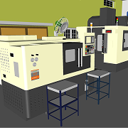
We do more than collect scan data. Our engineering team transforms captured reality into valuable deliverables such as CAD drawings, BIM models, Plant3D models, Digital Twins, and asset intelligence.
Survey-Grade
Accuracy
Our workflows are designed for engineering applications where accuracy is critical, including retrofit projects, prefabrication, quality verification, and plant modifications.
Minimal Site
Downtime
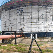
Large facilities can often be scanned while operations continue, reducing production interruptions and project delays.
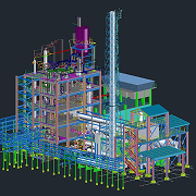
End-to-End Digital
Workflow
From site planning to engineering deliverables, we manage the complete Reality Capture process.
Our 3D Laser Scanning Workflow
Consultation
Assessment
Strategy
Scanning
Registration
Assurance
Processing
Plant3D /
Digital Twin
Delivery
Applications
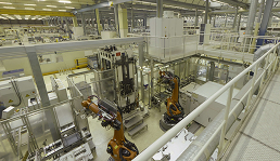
INDUSTRIAL PLANTS
Capture complex piping, equipment, structural steel, cable trays, tanks, and process facilities for retrofit engineering, maintenance planning, and Digital Twin creation.
- Brownfield Retrofits
- Plant Modifications
- Shutdown Planning
- Process Engineering
- Equipment Replacement
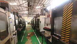
MANUFACTURING FACILITIES
Digitize production lines, machinery, conveyors, robotic cells, and factory layouts for modernization, automation, and expansion projects.
- Factory Layout Planning
- Production Line Documentation
- Machine Relocation
- Capacity Expansion
- Lean Manufacturing Studies
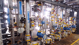
OIL & GAS
Generate accurate digital documentation of refineries, pipelines, offshore structures, terminals, and processing facilities.
- EPC Projects
- Asset Integrity
- Shutdown Maintenance
- Piping Documentation
- Safety Reviews
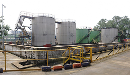
CHEMICAL PLANTS
Capture congested process environments where traditional measurements are difficult or unsafe.
- Improved Retrofit Design
- Accurate Plant Models
- Reduced Engineering Risk
- Clash-Free Modifications
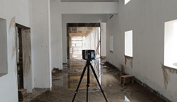
COMMERCIAL BUILDINGS
Create accurate as-built documentation for office buildings, malls, hospitals, hotels, educational campuses, and mixed-use developments.
- Floor Plans
- Elevations
- Sections
- BIM Models
- Facility Documentation
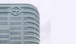
INFRASTRUCTURE
Digitally document bridges, tunnels, airports, railways, highways, ports, dams, and public infrastructure assets.
- Existing Conditions Surveys
- Asset Management
- Rehabilitation Planning
- Structural Assessment
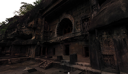
HERITAGE STRUCTURES
Preserve historically significant buildings, temples, monuments, museums, and archaeological sites using non-contact laser scanning.
- Permanent Digital Archive
- Conservation Planning
- Restoration Documentation
- Heritage Preservation
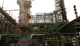
POWER PLANTS
Capture turbines, boilers, substations, cooling systems, and auxiliary facilities for maintenance, upgrades, and engineering analysis.
- Maintenance Planning
- Retrofit Support
- Cost Reduction
- Enhanced Safety
- Asset Inventory & Documentation
Industries We Serve
 Manufacturing
 Automotive
 Aerospace
 Defence
 Marine &
Shipbuilding
 Oil & Gas
 Chemical
 Pharmaceutical
 Cement
 Steel
Steel
 Power
PowerGeneration
 Mining
 Infrastructure
 Construction
 Commercial
Real Estate
 Warehousing
 Logistics
 Healthcare
 Universities
 Government
Deliverables
Registered
Point Clouds
Professionally registered and geo-referenced point clouds ready for engineering applications.
As-Built
Documentation
Accurate documentation of existing site conditions for renovation, expansion, maintenance, and future reference.
- Existing Conditions Reports
- Site Documentation
- Facility Records
- Digital Archives
Engineering
Measurements
Perform highly accurate digital measurements directly from the captured point cloud.
- Distances
- Heights
- Levels
- Clearances
- Pipe Dimensions
- Equipment Positions
- Structural Geometry
Digital Site
Records
Create permanent digital records that can be reused throughout the asset lifecycle.
- Future Expansion Planning
- Facility Management
- Asset Documentation
- Digital Twin Foundation
- Maintenance Planning
Additional
Engineering
Deliverables
Depending on project requirements, we also provide
- CAD Drawings
- Floor Plans
- Elevations
- Sections
- General Arrangement Drawings
- Scan to BIM
- Revit Models
- IFC Models
- Plant3D Models
- Clash Detection
- Deviation Reports
- Quantity Surveys
- Asset Registers
- Digital Twins
Advantages of 3D Laser Scanning
 Millimetre-Level
Accuracy
 Complete
Existing Conditions
Documentation
 Rapid Data
Capture
 Reduced Manual
Measurements
 Lower
LowerEngineering Risk
 Faster Project
Execution
 Supports Brownfield
Projects
 BIM & CAD Ready
 Digital Twin
Compatible
 Long-Term
Digital Asset
3D Laser scanning Project Workflow
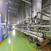
Existing Facility
Survey
Capture the current physical environment before design or construction begins.
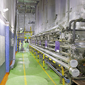
Point Cloud
Processing
Clean, register, and optimize scan data.
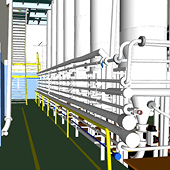
Engineering
Modelling
Convert scan data into CAD, BIM, Plant3D, or Digital Twin deliverables.
Client
Validation
Review outputs with stakeholders and verify project requirements.
Project Delivery
Provide engineering-ready datasets for design, construction, operations, or maintenance.
Why 3D Laser Scanning Instead of Traditional Surveying?
3D LASER SCANNING
- Captures millions of points
- Rapid field capture
- Complete digital archive
- Unlimited virtual measurements
- Comprehensive existing conditions
- Automated digital workflows
TRADITIONAL SURVEY
- Measures selected points
- Time-consuming
- Limited site record
- Difficult to revisit data
- Higher risk of missing information
- Manual documentation
Related Services
 Existing
Conditions
Survey
 Brownfield
Retrofit
Scanning
 Factory
Scanning
 Plant
PlantShutdown
Scanning
 Building
Scanning
 Mobile
SLAM
Mapping
 Drone
DroneLiDAR
Survey
 Drone
DronePhotogram
-metry
 Scan to
CAD
 Scan to
BIM
 Point Cloud
Processing
 Digital Twin
Development
Related Industries
 Manufacturing
 Oil & Gas
 Chemical
 Infrastructure
 Commercial
Buildings
 Power
PowerPlants
 Heritage
 Mining
 Utilities
 Marine &
Shipbuilding
Ready to Capture Your
Facility?
Whether you're planning a plant expansion, documenting an existing building, creating BIM models, or building a Digital Twin, WildPlantTS provides high-accuracy 3D laser scanning services tailored to your project.