
PRECISE S7 | PROFESSIONAL MOBILE LiDAR
Survey-Grade Mobile
LiDAR Scanning.
Capture More. Measure Faster.
The PRECISE S7 is a professional handheld mobile LiDAR scanner designed for fast, accurate 3D reality capture across buildings, infrastructure, industrial facilities, construction sites, terrain and complex environments.
Combining MLF-SLAM, RTK, PPK, GNSS, LiDAR, IMU and panoramic imaging, the S7 allows surveyors, engineers and reality-capture professionals to collect detailed 3D spatial data while walking through the project.
With up to 200,000 points per second, a maximum detection range of 70 m, and absolute accuracy of <3 cm in post-processing, the S7 is built for professional mobile mapping applications.
Now available in India through WildPlantTS — Master Reseller of PRECISE Mobile LiDAR solutions.

~1.08 kg
Ultra-Lightweight

360°
LiDAR Coverage

200K pts/s
LiDAR Point Rate

≤2 cm
Relative Accuracy

≤5 cm
Absolute Accuracy

150 min
Working Time
A Mobile LiDAR Scanner Built for Real-World Surveying
Walk through the environment and capture it in 3D.
As you move, the S7 combines LiDAR measurements, inertial data, visual information and positioning technologies to continuously build a three-dimensional representation of the environment.
 Large Areas
 Complex
Buildings
 Industrial
Plants
 Infrastructure
Corridors
 Indoor
Environments
 GNSS-
GNSS-Challenged
Areas
 Rapid
RapidSurveying
Requirements
 Difficult-to-
Access
Spaces
 Repeated Site
Documentation
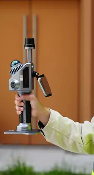
More Than a Handheld Laser Scanner
A complete mobile mapping platform.

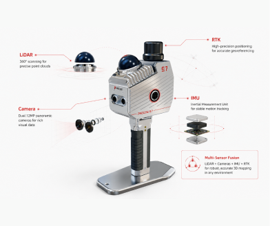
LiDAR
Detailed spatial measurements

MLF-SLAM
Continuous mobile mapping & positioning

RTK
High-precision GNSS positioning

PPK
Post-processing positioning

IMU
Movement & orientation tracking
Panoramic Imaging
Adds visual context to spatial data
Mapping modes:
MLF-SLAM • PPK-SLAM • RTK-SLAM • SLAM
MLF-SLAM for Mobile 3D Mapping
Map complex environments without relying on continuous GNSS visibility

Keep Moving
Capture while you walk, naturally.

Reduce Setup Time
Avoid repeated scanner setup.

Map Complex Spaces
Works in challenging conditions.

Support Indoor Mapping
Capture where GNSS is not available.

Improve Field Productivity
Capture more in less field time.
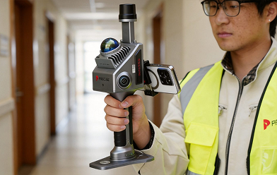
SLAM + RTK + PPK. Choose the Right Positioning Workflow.

RTK-SLAM
Real-time GNSS with SLAM for georeferenced projects.

PPK-SLAM
Post-processed positioning for higher control.

MLF-SLAM
Advanced MLF-SLAM for continuous mapping.

Conventional SLAM
Ideal for indoor & GNSS-challenged environments.

GCP Support
Built-in tools simplify ground control collection.
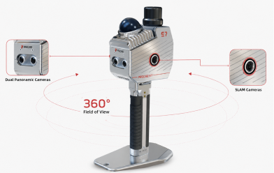
Capture 200,000 Points Every Second
Mid360 LiDAR for high-speed, high-detail capture.
- 200,000 points per second
- 360° horizontal FOV
- 10° to 52° vertical FOV
- 2 cm LiDAR accuracy
- 905 nm laser wavelength
- Class 1 eye-safe laser
- Up to 70 m detection range (at 80% reflectivity)
Surveying Performance You Can Depend On
Professional accuracy for real-world projects.
- <3 cm — Absolute Accuracy (Post-Processing)
- 2 cm — Relative Accuracy
- 2 cm — Repeat Accuracy
- 0.025° — Horizontality / Verticality
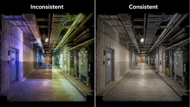
Intelligent Positioning Engine Enhanced by MATRIX Algorithm
PRECISE MATRIX positioning engine delivers super-high fix rate performance.
99.9%
Super-high Fix Rate under normal field conditions
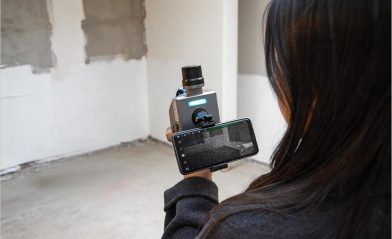
See Your Point Cloud in Real Time
Real-time true-color point cloud preview on Android app.
- Real-time true-color point cloud
- Monitor coverage on-site
- Stream, download and replay data
- Verify before leaving the site
- Rescan missing areas immediately
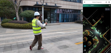
Ultra-Lightweight Design Built to Move
Just over 1 kg. Easy to carry.
Built for long scanning days.
~1.3 kg
Total System Weight
Main Unit: ~1.3 kg (with base, battery & RTK module)
 Portable
 Comfortable
 Single
Operator
 Go
GoAnywhere
Power for Long Field Days
Scan longer. Swap or power externally.
Keep working.

2.5 hrs
Battery Life

3450 mAh
Battery
Capacity

USB-C PD
Fast Charging
(30 W)

Extended
Operation
with Power
Bank

Quick Release
Battery Design

120 min
Charging Time
High-Density, Survey-Grade Data
High-speed capture. High-accuracy results.

200,000 pts/s
LiDAR Point Rate

≤1 cm
Point Cloud Thickness

≤2 cm
Relative Accuracy

≤5 cm
Absolute Accuracy
One Mobile LiDAR Platform.
Multiple Applications.
 Construction
& BIM
 Industrial
Plants
 Infrastructure
 Surveying
& Mapping
 Mining &
Quarries
 Forestry &
Environment
 Heritage
& Culture
 Tunnels &
Underground
 Smart Cities &
Urban Mapping
 Utilities
 Public Safety &
Investigation
From Walking the Site to a 3D Digital Reality
PLAN
Define your project area, capture requirements and positioning strategy.

CAPTURE
Walk through the environment while the S7 continuously captures spatial data.

VERIFY
Review, visualize and evaluate data during the field workflow.
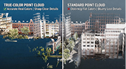
PROCESS
Process the captured LiDAR, imaging and positioning data using the appropriate software.

DELIVER
Generate point clouds and documentation deliverables for surveying, BIM, CAD, GIS, Digital Twins and engineering.

More Than LiDAR. An Integrated System.

LiDAR
Rapidly capture millions of laser measurements.

SLAM
Simultaneously estimate position and map the environment.

RTK
Support georeferenced mapping where GNSS is available.

PPK
Enable post-processing positioning for applicable projects.

IMU
Capture movement and orientation as you move.

Imaging
Add visual information for better interpretation and documentation.
Turn Reality Capture into Engineering Data
 3D
3DPoint Clouds
 GIS Data
 Coloured
Point Clouds
 Digital Twins
 As-Built
Documentation
 Orthographic
Outputs
 3D Models
 Facility
Documentation
 BIM
BIMDocumentation
 CAD Reference
Data
 Survey
Documentation
 Engineering
Analysis
Built for Professionals Across Industries
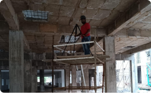
CONSTRUCTION & BIM
As-built documentation, clash detection, progress monitoring.
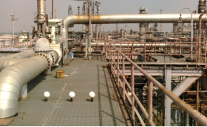
OIL & GAS PLANTS
Plant digitization, maintenance planning, shutdown projects.
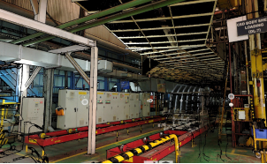
MANUFACTURING &
AUTOMOTIVE
Factory layouts, digital twins, reverse engineering support.
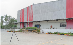
INFRASTRUCTURE &
BRIDGES
Roads, bridges, railways, airports, metro projects.
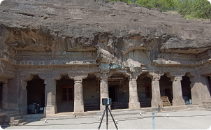
HERITAGE DOCUMENTATION
Temples, forts, palaces, museums, cultural preservation.
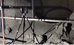
MINING & QUARRY
Stockpile analysis, terrain modeling, site monitoring.
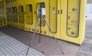
FACILITY MANAGEMENT
Building maintenance and asset management.
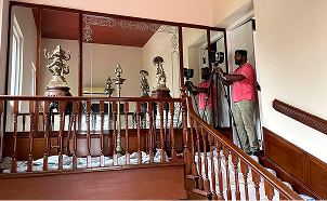
ARCHITECTURE &
SURVEYING
Existing conditions, renovation planning, site analysis.
Your PRECISE Mobile LiDAR Partner in India
WildPlant Terrestrial Solutions Pvt. Ltd. (WildPlantTS) is the Master Reseller of PRECISE Mobile LiDAR scanners in India. We go beyond technology training hardware. Our team helps organizations identify the right mobile LiDAR workflow for their project, understand the appropriate SLAM and positioning workflow, execute applications and deploy the system effectively.

Master Reseller
in India
Official sales channel for PRECISE Mobile LiDAR solutions in India.

Application
Consultation
Understand your project before recommending the scanner.

Live
Demonstrations
See the technology working in real-world applications.

Training &
Implementation
Support experts in adopting the mobile LiDAR workflow.

Technical &
After-Sales Support
Continued assistance throughout your scanner's deployment.